
Arches National Park
Arches is an amazingly beautiful park. It’s so gorgeous you almost get “beautiful desert landscape” fatigue.
It’s located just north of Moab, UT. You enter the park at the south end from U.S. Highway 191. The main road runs from the Visitor Center in the south to the Devils Garden Trailhead at the north end of the park.
About midway thru, there’s a road leading to the Windows Section. This is the densest collection of arches in the park, with short, easy trails connecting them.
A couple miles further north is the road leading to Wolf Ranch and Delicate Arch.
You can download a Park Map or the Visitor Guide from the National Park Service site for the park.

Park Avenue
Just north of the Visitor Center is the Park Avenue trailhead. I overhead a ranger describe it as a mini Monument Valley, which seems just about right. The trail is fairly easy, but even if you don’t hike it, you can get some beautiful photos.


The Tower of Babel, this formation is about 350 feet tall. Just massive.

Balanced Rock, right before the turn-off to the Windows
The Windows
It’s arch-a-palooza here with short, easy hikes to the arches. It’s named for two large arches the North and South Windows.

North Window

Under the North Window, looking up at the ginormous crack.

South Window

Turret Arch

Turret Arch, up close

South Window viewed thru Turret Arch. Oooh, arty.
This is approximately half of the arches here. Seriously. I hit this last. I was dog tired, got sunscreen and sweat in my eye, and it was about 102°, so I didn’t walk over to the other arches. Fair warning, this is the one section that even the people who won’t get out of their cars will see. Expect crowds of possibly annoying humans. Your mileage may vary.
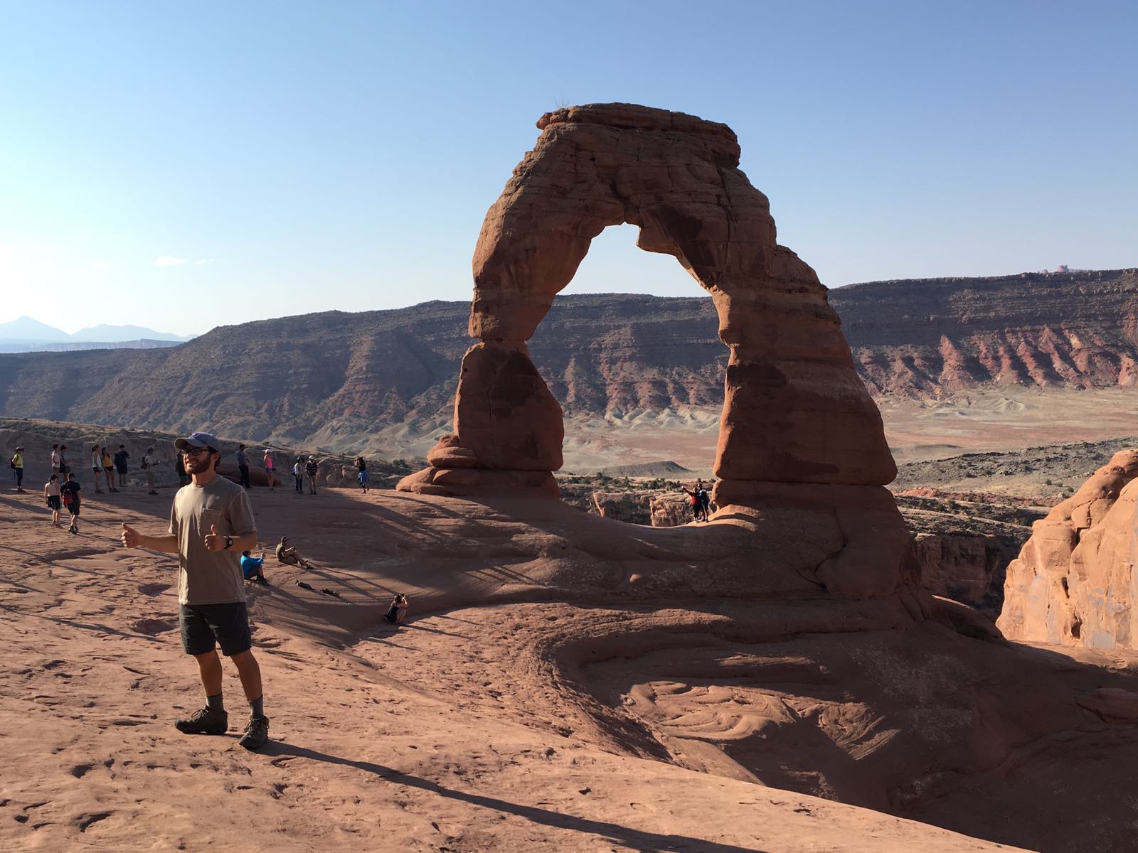
Delicate Arch
So they got the name of this one wrong, it’s clearly License Plate Arch. There are two ways to see this one. The easy way involves a short hike over flat ground, but you end up viewing it from a distance. The hard way is a 3 mile round trip, about half of which is up a steeply sloping pitch of rock. But the hard ways pays off, as you get to stand under the arch. Take plenty of water and do this hike as early in the day as you can.


The top half of the hike is over “slick rock,” like what you see in the foreground. Cool, right?

There can be a long line to get out under the arch, as people coordinate with other groups to take their picture. Or if you are anti-social, like me, you can just quickly dart out there and take some photos. Stink-eye makes you stronger.
Devil’s Garden Trailhead
Lots of arches here too, but the hikes are longer and more difficult. The hike to Landscape Arch is pretty flat and easy, tho. It’s about a mile and half round trip.

Landscape Arch

Arguably, this is the delicate arch. On September 1, 1991, while people were standing under it, a 60-foot slab of rock broke off. Altogether 180 tons of rock splintered off the arch. Nobody got hurt because the collapse was preceded by loud cracking and popping noises that warned people to, you know, run for their lives. They don’t let you go under this one anymore.

There are a lot of rock fins in the area, too. I didn’t hike to the other arches out here. Can’t see it all in one day.